Earth Sciences
The Institute of Earth Sciences (IES), originally established as the Department of Geology in 2014, offers a program in BS Applied Geology with a primary focus on providing comprehensive training in the field of Earth Sciences. Actively engaged in uncovering and utilizing the natural resources of the country, the IES plays a crucial role in advancing the socio-economic landscape. It proudly serves as a key resource for Research Organizations, Universities, National and International Hydrocarbon Companies, Geotechnical Firms, NDMA, SDMA, P&D, C&W, WAPDA, PWD, PMD, AKMIDC, FWO, GSP, other Mining Organizations, Geological Surveys, and Civil Work Industry, contributing significantly to the development of a skilled workforce in the nation.
Collaborations:
Graduates of the IES can be found in various organizations dedicated to geosciences in Azad Kashmir, Pakistan, and internationally. The IES has a history of successful collaborations with esteemed foreign universities such as the Nanjing Institute of Geology and Paleontology, Chinese Academy of Sciences in China, Institute of Geology at the University of Azad Jammu and Kashmir, Department of Earth Sciences at Karakorum International University in Gilgit Baltistan, Ghulam Ishaq Khan Institute, COMSAT- Abbottabad as well as with national bodies like the National Disaster Management Authority, State Disaster Management Authority, Weatherwalay-Pakistan, Pakistan Meteorology Department, Islamabad, Communication and Works Department in Pakistan, Power and Works Department of AJK, Geotechnical and Oil Companies, and the Geological Survey of Pakistan. The faculty members of the IES are actively engaged in diverse research projects in collaboration with various national and international organizations. Many faculty members are pursuing Ph.D. programs in Geosciences.
Job Opportunities:
The IES aims to produce skilled professionals in the field of Geosciences to meet the demands of national and international markets. Graduates have opportunities for employment in universities, colleges, research institutes, oil companies, geotechnical organizations, WAPDA, the Atomic Energy Commission, highways, geological surveys, geoservices companies, hydrocarbon development institutes, and numerous other national and international organizations. The IES facilitates practical training and internships for its graduates in a range of geotechnical organizations, both national and international, as well as in highways, oil companies, research institutes, and hydropower projects like Neelum Jhelum Hydropower and AKMIDC. Graduates have pursued their MS and Ph.D. programs in countries such as China, the United Kingdom, Australia, Canada, Germany, and France etc. The IES plans are underway to introduce Masters and Ph.D. programs in the near future.
History
Since 2014, the IES has been actively engaged in multidisciplinary research within the field of earth sciences, focusing on various aspects of geological hazards such as landslides, earthquakes, floods, and related phenomena. Research efforts extend to Geospatial Data Analysis, Remote Sensing, Geodetic Instrumentation, Sedimentation studies, Paleoenvironmental reconstructions, Stratigraphic and Structural Interpretations, Climate Change investigations, geophysical subsurface Imaging, and exploration, as well as Geotechnical Investigation and experimentation. Research students are rigorously trained in report writing throughout their coursework, with the submission of a research thesis being a mandatory requirement for degree completion.
Initiative to combat climate change:
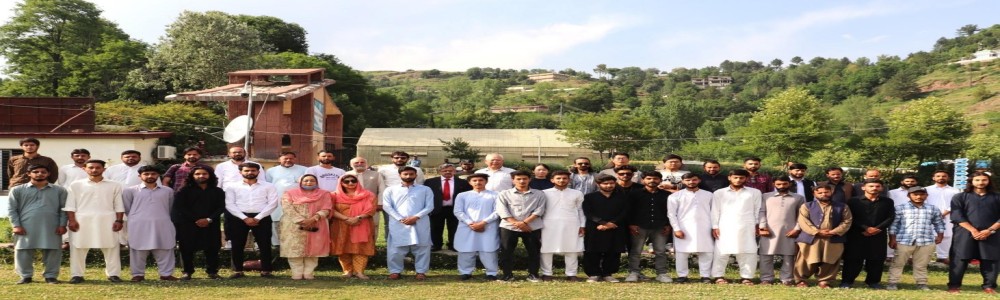
In a strategic move to combat climate change in the northwestern Himalayas, IES has forged a groundbreaking partnership with WeatherWalay, Pakistan's foremost Digital Weather service provider. This collaboration marks a significant step towards establishing an online real-data collection initiative aimed at delivering precise and hyper-local weather information to users. By deploying state-of-the-art Automated Weather Stations (AWS), we are revolutionizing the accessibility of accurate weather data in the region.
Through this strategic collaboration, IES and WeatherWalay are spearheading a transformative initiative to empower communities in the northwestern Himalayas with the tools and knowledge necessary to navigate the impacts of climate change effectively. By harnessing cutting-edge technology and data-driven solutions, we aim to enhance resilience, promote sustainable practices, and contribute to the collective effort to mitigate the effects of climate change in this ecologically sensitive region.
*The weather data can be provided for the research purposes on request.
Field and Laboratory Trainings:
The IES is dedicated to providing comprehensive practical training to its students, encompassing both fieldwork and laboratory exercises. Students undergo a structured training program that covers a spectrum from fundamental to advanced levels of geological study.
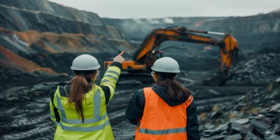
The IES places a strong emphasis on experiential learning by organizing field trips to various geological sites, including the Northern Areas of Pakistan, Punjab Platforms, Salt Ranges of Pakistan, and Southern Azad Kashmir. These field excursions are meticulously planned to provide students with firsthand exposure to diverse geological landscapes and formations under the guidance of experienced faculty members. By accompanying students on these trips, faculty members not only enhance the educational experience but also offer valuable insights and expertise gained from years of practical experience in the field. Through these field visits, students have the opportunity to apply classroom knowledge to real-world scenarios, honing their observational skills, geological mapping capabilities, and rock identification techniques. Exploring these geologically significant regions allows students to witness the complexities of the Earth's processes up close, fostering a deeper appreciation for the natural world and enriching their academic journey in geology.
Field Activities:
- Field trips to diverse geological sites such as the Northern Areas of Pakistan, Punjab Platforms, Salt Ranges of Pakistan, and Southern Azad Kashmir.
- Field tours typically span from 3 to 14 days, allowing students hands-on experience in mapping geological formations and identifying various rock structures.
- Practical exercises involving the interpretation of structural features imprinted on rocks.
- Conducting geological surveys to understand the composition and characteristics of different geological formations.
- Studying landforms and their geological significance in various regions.
- Collecting rock samples for analysis and classification.
- Analyzing the geological history and processes that have shaped the landscape.
Laboratory Activities:
- Hands-on experience in using geological tools and equipment for sample analysis.
- Geo-technical Laboratory experiments to understand the soil and aggregates behavior in different conditions.
- Mineral identification and classification exercises.
- Petrological studies involving the examination of rock textures, mineral assemblages, and geological histories.
- Geochemical analysis of rock samples to understand their composition and origins.
- Structural geology experiments to simulate rock deformation processes.
- Seismic interpretation exercises to understand subsurface structures.
- Paleontological studies involving the examination of fossil specimens and their significance in geological history.
- Geophysical surveys to study subsurface features and geological anomalies.
The combination of field and laboratory activities equips students with practical skills and theoretical knowledge essential for a successful career in the field of geology.
Services Offered:
Geotechnical Laboratory Testing: Our specialized geotechnical laboratory testing services involve a meticulous analysis of soil and aggregate samples to assess their composition, strength, and suitability for various engineering and construction projects. By providing comprehensive data on the properties of these materials, we assist clients in making informed decisions for their projects, ensuring structural integrity and stability.
Subsurface Imaging: Through cutting-edge subsurface imaging techniques, we offer precise and detailed insights into underground structures, groundwater resources, and mineral deposits. Our expertise in subsurface imaging facilitates efficient groundwater exploration, mineral surveys, and mining operations, enabling clients to optimize resource utilization and make informed decisions based on accurate subsurface data.
Ancient Architectural Studies: Our ancient architectural studies delve into the historical significance and structural integrity of architectural heritage sites. By conducting detailed examinations and research on these structures, we contribute to their preservation, restoration, and historical understanding. Our studies provide valuable insights into the cultural heritage and architectural achievements of past civilizations.
Comprehensive Mapping and Profiling: Our comprehensive mapping and profiling services involve the detailed assessment and visualization of geological hazards at both micro and macro scales. By identifying and mapping potential risks such as landslides, seismic zones, and flood-prone areas, we aid in risk mitigation strategies and urban planning. Our precise mapping techniques enable clients to make informed decisions for sustainable development and infrastructure projects.
GIS and Remote Sensing Data Analysis: Leveraging advanced Geographic Information System (GIS) and remote sensing technologies, we provide in-depth analysis and interpretation of geospatial data. Our services enable clients to create accurate maps, conduct environmental monitoring, and model spatial phenomena for a wide range of applications. By harnessing the power of GIS and remote sensing, we offer valuable insights for informed decision-making and resource management.
Geochemical Testing: Our geochemical testing services entail the analysis of chemical compositions in geological samples to understand elemental distributions, mineral associations, and geochemical processes. By conducting thorough geochemical assessments, we assist clients in mineral exploration, environmental studies, and geological research. Our precise testing methods provide valuable data for identifying mineral resources and assessing environmental impacts.
Petrological Studies: Our petrological studies involve in-depth analysis of rock formations to unravel their origin, mineral composition, and geological significance. By examining the texture, mineralogy, and structural features of rocks, we provide insights into their formation processes and geological history. Our petrological studies are essential for understanding the evolution of geological environments and interpreting the Earth's dynamic processes.
These specialized services not only contribute to advancing scientific knowledge but also cater to the practical needs of our clients, fostering collaboration and knowledge exchange between IES and the broader community.
*These services can be availed upon request by reaching out to us via email or by contacting us directly.
Mission & Vission
Mission Statement
Our mission is to pioneer excellence in earth sciences education, research, and professional services. We are committed to providing students with immersive practical training experiences that integrate fieldwork and laboratory exercises, preparing them for successful careers. Through multidisciplinary research focusing on geospatial analysis, remote sensing, geophysical imaging, geological hazards, geochemical and various geological studies, we aim to advance scientific knowledge and address real-world challenges.
Vision Statement
Our vision is to be a globally recognized center in earth sciences, known for our innovative research, transformative educational programs, and impactful services. We aspire to be at the forefront of geoscientific innovations, leveraging cutting-edge technologies and methodologies to unravel the complexities of the Earth's processes. By fostering a culture of collaboration, knowledge exchange, and community engagement, we seek to make significant contributions to the fields of geology, environmental science, disaster preparedness and resource management. Our vision is to empower future geoscientists, researchers, and industry professionals to address pressing geological challenges and to promote sustainable practices for the benefit of society and the environment.
Message From HOD
As the Head of Department (HoD) of the Institute of Earth Sciences (IES), I am delighted to welcome you to our virtual platform, where we showcase our unwavering commitment to excellence in multidisciplinary research and practical training in the field of earth sciences. At IES, we pride ourselves on our pioneering initiatives aimed at addressing critical issues such as geological hazards, climate change, and sustainable resource management. Through cutting-edge research endeavors spanning geospatial data analysis, geotechnical investigations, and paleoenvironmental reconstructions, our dedicated team of researchers and students is at the forefront of scientific exploration and discovery. Our recent collaborations with academia and industry represents a significant milestone in our efforts to combat climate change in the northwestern Himalayas and other geological hazards. By harnessing state-of-the-art technology and data-driven solutions, we are empowering communities with essential weather information and geoscientific knowledge to enhance resilience and promote sustainable practices in the face of environmental challenges. The cornerstone of our academic programs lies in the comprehensive practical training we provide to our students, integrating fieldwork and laboratory exercises to foster a holistic understanding of geological principles. From field trips to diverse geological sites to hands-on experience in geo-technical laboratory experiments, our students are equipped with the skills and knowledge necessary for a successful career in geology. IES specialized services in geotechnical laboratory testing, subsurface imaging, ancient architectural studies, comprehensive mapping, GIS and remote sensing data analysis, geochemical testing, and petrological studies underscore our commitment to advancing scientific knowledge and supporting the practical needs of our country.I invite you to explore the wealth of opportunities and resources that IES has to offer, whether you are a prospective student, researcher, or industry partner. Our dedicated faculty and staff are here to support your academic and professional journey, providing expertise, guidance, and a collaborative environment for impactful research and learning. For further information on our programs, research activities, or specialized services, please do not hesitate to reach out to us. Together, let us continue to explore the wonders of the Earth and strive towards a more sustainable and resilient future
Programs
BS (Applied Geology)
Duration: 4 Years
Duration: 4 Years

BS Islamic Studies
Duration: 4 Years
Duration: 4 Years
B.Ed. (Hons) Elementary
Duration: 4 Years
Duration: 4 Years
A.D Education
Duration: 2 Years
Duration: 2 Years